
Walk a Daphne Street Record
A useful Daphne street directory does not begin with a guessed name. It begins with one exact address and builds outward. The Baldwin County Revenue Commission ties the street number to a parcel, account, and owner record. The parcel map then shows the lots beside it. Recorded instruments carry that owner name backward, while voter and historical directory evidence can add a carefully labeled clue about who used the address.
- Normalize the mailing line with USPS, then confirm city jurisdiction in parcel and Daphne GIS records. A Daphne postal name alone does not prove that the land sits inside city limits.
- Run street number and street name in the county property search. Save the tax year, account, parcel, PIN, physical address, owner, mailing address, subdivision, and legal description.
- Open the county parcel viewer. Pan along the street and click each lot, keeping duplex units, common parcels, rights-of-way, and condominium interests in separate rows.
- Search the named owner in Baldwin Official Records. Use the deed's grantor, grantee, recording date, instrument number, book/page, and legal description to confirm the same land.
- Add occupancy evidence only when a lawful voter extract or a historical directory supplies it. Label each person by the role the source actually proves.
This sequence prevents the most common error: turning an assessed owner into a full household. It also makes a whole-street project repeatable. Each row can preserve source date, parcel identity, and the exact kind of address shown.
Daphne Street Directory Search Fields
The free Baldwin County online record gateway is the direct address starting point. Address mode separates the street number from the street name. Other modes help when the same street spelling fails or when a parcel identifier is already known. Name mode has a last-name field, an optional first name, and starts-with or contains matching.
| Mode | Fields | Best Street Use |
|---|---|---|
| Address | Street number; street address | Start from one known Daphne location |
| Name | Last name; optional first; starts with or contains | Check parcels tied to a known owner |
| PIN, Parcel, Account | County identifier | Return to the exact land record |
| Subdivision | Recorded subdivision name | Group lots when the street label varies |
| Company | Entity name | Find parcels assessed to an organization |
Results may be sorted, printed, and shown in page sizes from five through fifty. Visible result fields include description, account, parcel, year, billing year, PIN, total tax, and balance due. Record the year before treating a name as current. County web data may lag courthouse activity.
The property gateway shown here makes those modes visible before a search begins.
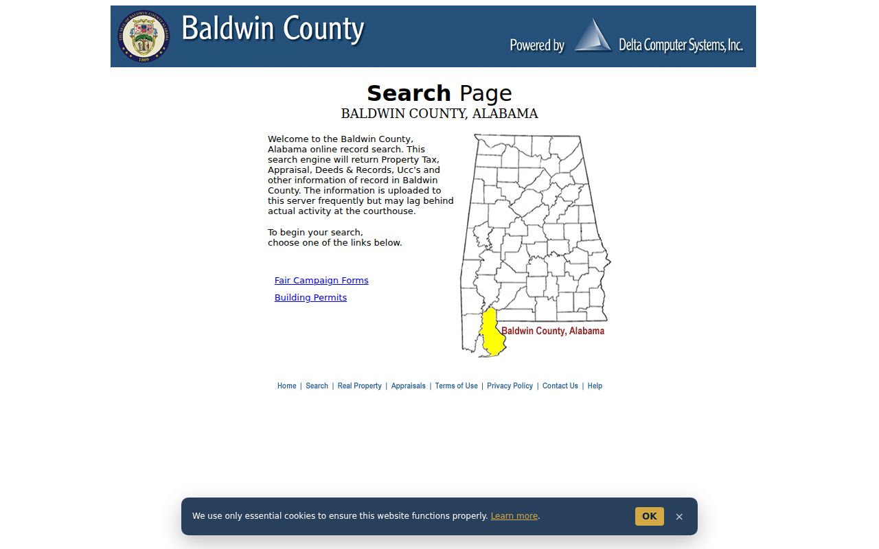
Its separate address and identifier paths support a street-by-street ledger without treating a loose name match as proof.
Daphne Addresses Have Different Roles
The physical or situs address locates the parcel. The mailing address is where the Revenue Commission sends the tax notice. A deed may also contain buyer and seller addresses, a preparer's address, and a return destination. Those fields are useful, but none automatically proves where each named person lived.
- Parcel
- A mapped unit of land with county identifiers such as a parcel number, PIN, or account.
- Situs address
- The physical location assigned to the land or structure, separate from the tax mailing destination.
- Plat
- A recorded drawing that identifies subdivision lots, blocks, streets, and other boundaries.
- Criss-cross directory
- A directory arranged by address or telephone number instead of only by a person's surname.
A matching situs and mailing address, paired with a homestead indicator, can support an owner-occupancy inference. It still does not identify every Daphne resident at that home. An out-of-town mailing address may show an absent owner, a business office, or another valid notice address.
Note: Keep every address type in its own field so a tax-mail destination never becomes an unsupported claim of residence.
Browse Daphne Streets in GIS
The Revenue Commission search page launches both property records and the county map viewer. This is the safer entry point when a typed address finds several parcels or a street-name variant. Browse by map, zoom to the target, click the parcel, then carry its PIN or account back into appraisal details.
The official launch screen pictured below distinguishes the record search from the map route.
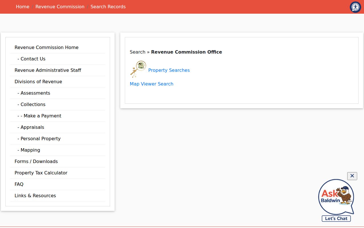
That choice matters because the roll answers who is assessed, while the map answers which parcel sits beside which.
The Baldwin County parcel viewer supports the verified visual method: pan, zoom, and click parcels. No public radius or buffer feature was confirmed, so a Daphne street directory should not promise one. The county also warns that its maps and legal descriptions serve tax purposes. A recorded plat or deed remains the stronger source for title boundaries.
The county GIS view shown here supplies the geographic bridge between adjacent lots and appraisal records.
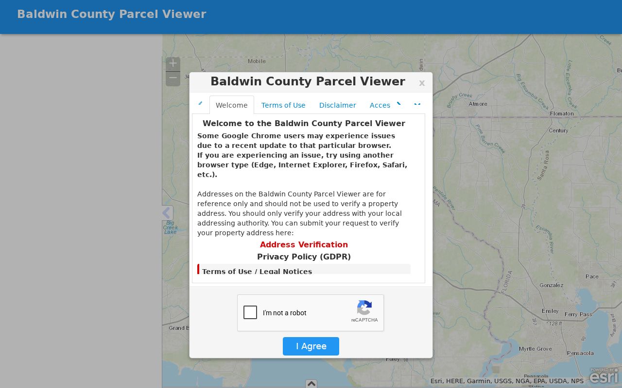
Use each clicked parcel as a separate record, especially around condominiums, shared tracts, and association property.
Daphne Records Indexed by Address
No one Daphne directory source covers a full street. The sources below overlap, but their roles differ. The property roll and parcel map are open web tools. Deeds are indexed mainly by party and legal details. Permits require city channels. Voter information uses a statutory order rather than an open street browser.
| Address Evidence | Custodian | What It Establishes | Access Route |
|---|---|---|---|
| Property and tax roll | Baldwin Revenue Commission | Assessed owner, physical and mailing addresses, parcel IDs, tax year | Free web search or office |
| Parcel GIS | Baldwin County; Daphne GIS | Parcel shape, adjacency, and jurisdiction context | Free map viewers |
| Deeds, liens, plats | Baldwin Judge of Probate | Recorded parties, legal description, instrument history | Online from 1899; counters, mail, archives |
| Voter list | Alabama Secretary of State | Selected public registration fields, subject to protection | Paid statutory data order |
| Permit and inspection file | Daphne Building Inspection | Job site, subdivision or lot, contractor, work and inspection dates | Email or city records request |
| Historical directories | ADAH and regional libraries | Named occupants, phones, and addresses depending on issue | Reading room, reference, or selected scans |
A parcel number joins the map to tax details. An owner name and legal description bridge into deeds. The street name links permits and directory entries, but spelling variants must be preserved rather than invented. Highway 98 and U.S. 98, for example, should only be treated as variants when the official source displays them.
Anchor Daphne Streets to Land
Street labels can shift while the land identity remains stable. Convert a Daphne address into its subdivision, lot, block, parcel identifiers, and legal description as early as possible. In annexed or less urban parts of the Daphne postal area, a metes-and-bounds description may be the only durable bridge. That term means a boundary written from measured courses, distances, and landmarks rather than a platted lot number.
Recorded plats belong to Baldwin Probate, county archives, and city planning channels. Baldwin County Archives holds plats from 1830 through 1979 and lot books from 1919 through 1979. When a street name is missing from an old index, these records can connect the present parcel to an earlier lot or tract.
No verified citywide Daphne renumbering year was found. A careful street directory does not invent one. Compare the legal description, recorded plat, maps, adjoining parcels, and nearby directory entries instead.
Note: USPS standardizes mail delivery, but parcel GIS and annexation records decide which local government holds a Daphne-area record.
Follow Daphne Owners Past 1899
The Baldwin Official Records Search carries deeds and mortgages from 1899, Book 1, through the present. That span is the street page's main numbers story: more than a century of recorded ownership evidence is available online. The index can be searched by a party, document number, book/page, subdivision or legal field, date range, and OCR phrase.
The quick-search screen pictured here shows its search term, date range, recording-date shortcuts, and index-only or full-text choice.
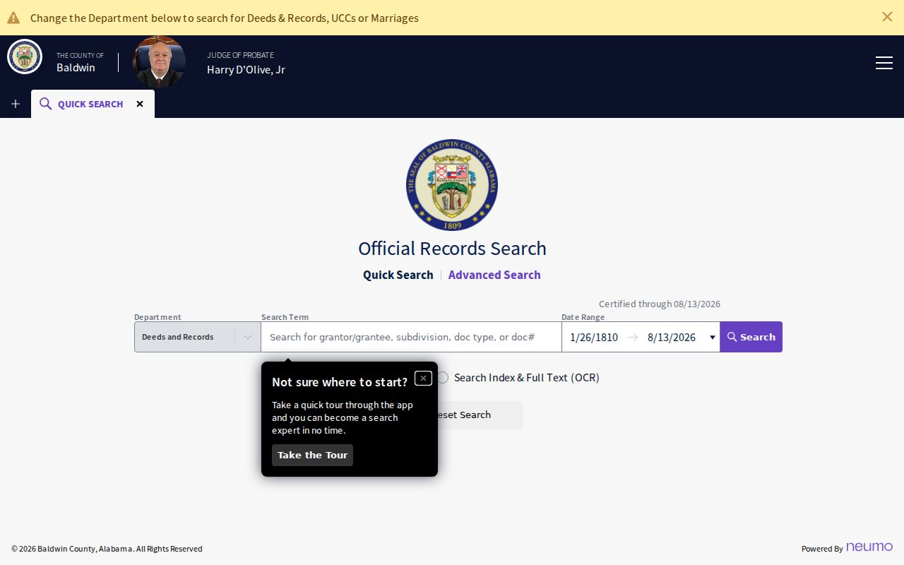
For a specific parcel, the current owner's acquisition deed is a better first target than a loose address phrase.
Search that buyer as grantee, meaning the person or entity receiving an interest. Record the grantor, who transferred it, plus the date, instrument, book/page, and legal description. Then search the seller as an earlier grantee. Confirm OCR hits against the recorded image. When the chain crosses 1899, use office viewing stations, mail or counter copies, and Baldwin County Archives deed books. The Archives holds deeds, liens, and mortgages dating to 1804.
Daphne Street Permits and Voters
Daphne Building Inspection accepts inspection requests with contractor, permit, contact, subdivision, lot or phase, physical job-site address, inspection type, and requested date. Those fields can date work on a structure. They do not create a resident roster. For older permits, certificates, or enforcement material not already posted, use the signed Daphne public-record request. The city says it responds within five business days, while copying and staff research may carry the posted charges.
Alabama Votes works differently. Its personal lookup requires first name, last name, date of birth, and a challenge response. It cannot browse a Daphne street. A street-level voter file requires the Secretary of State voter-list order, with geography, status, fields, medium, and format selected. Electronic data costs one cent per voter; printed lists cost one dollar per page. Protected voters may be suppressed or leave only a name public.
Participation history can identify elections or a primary choice, never a person's ballot selections. Alabama does not register voters by party. For help, the nearest Board of Registrars counter is at the Fairhope Satellite Courthouse, 1100 Courthouse Avenue, phone 251-990-4614.
Read Older Daphne Streets Carefully
Historical occupancy is a separate task from present parcel ownership. Verified combined Fairhope-Daphne directory volumes exist for 1965, 1967, 1989, 1991, and 1996 at the Alabama Department of Archives and History. The University of South Alabama McCall Library reports a 1978 through 1992 span, but that statement does not prove every annual issue. Earlier Daphne names appear within Eastern Shore and Fairhope telephone books, including 1945 and 1949 issues.
Some old volumes are name-led, not true reverse directories. Manual scanning by street may be needed. A line can include a surname, given name, spouse, widow mark, occupation, employer, and house number. Copy the exact entry, then verify it against a deed, tax book, census, obituary, or probate file. The full shelf and entry conventions belong on the Daphne city directory page.
A missing name is not proof that the person left. The issue may be absent, the telephone unlisted, the surname changed, or the address outside that edition's coverage.
Daphne Street Directory Boundaries
Public address records do not reveal a full household. The tax roll identifies an owner or taxpayer, not all residents. Deeds prove recorded transactions, not current presence. Permit files identify work and often a contractor. Voter self-service is identity-gated, and a purchased list omits protected information. Driver records are restricted by federal law, while utility and delivery customer lists are not public directory feeds.
A city name on the mail line also has limits. Daphne's municipal boundary, county parcel geography, subdivision plats, and USPS routes are distinct. Check jurisdiction before sending a permit or planning request. County land tools remain central even when the site lies within Daphne.
Lawful use. Use Daphne street and address records for family history, property research, consumer safety, or civic inquiry. Never use them to stalk, threaten, harass, or track a person.
When evidence conflicts, retain both versions and their dates. The strongest street directory result is a sourced record of roles, not a claim that every name belongs in one home.