
Daphne ZIP Directory Coverage
Two verified ZIPs have a direct Daphne relationship. ZIP 36526 covers the core, central, and southern parts of Daphne. ZIP 36527 reaches north Daphne but is also tied to Spanish Fort. The table states only the relationships supported by official addresses and postal sources. It does not add mail-processing codes or assume that every point in a postal area belongs to Daphne.
| ZIP | Daphne Areas | Post Office | Boundary Note |
|---|---|---|---|
| 36526 | Core, central, and southern Daphne; Olde Towne; Lake Forest; most city offices | Daphne, 808 Daphne Avenue | Postal reach can cross the exact city line |
| 36527 | North Daphne, including the municipal Fire Station 4 address and TimberCreek | Spanish Fort, 6450 Highway 90 Suite 8A | Shared with Spanish Fort geography |
The practical result is simple. Use the Daphne ZIP code directory as a starting boundary, then verify the individual address. A 36527 result is not enough to label a site Spanish Fort or Daphne. A 36526 mailing line is not, by itself, proof of city jurisdiction.
Daphne ZIP 36526 Core
ZIP 36526 contains the clearest central Daphne postal identity. It includes Olde Towne, Lake Forest, many city offices, and much of central and southern Daphne. The Daphne Post Office at 808 Daphne Avenue anchors the postal evidence. Its published phone is 251-621-7314, with retail hours Monday through Friday 9 to 4:30 and Saturday 9 to noon.
The official Daphne Post Office listing is the source for that station identity and service information.
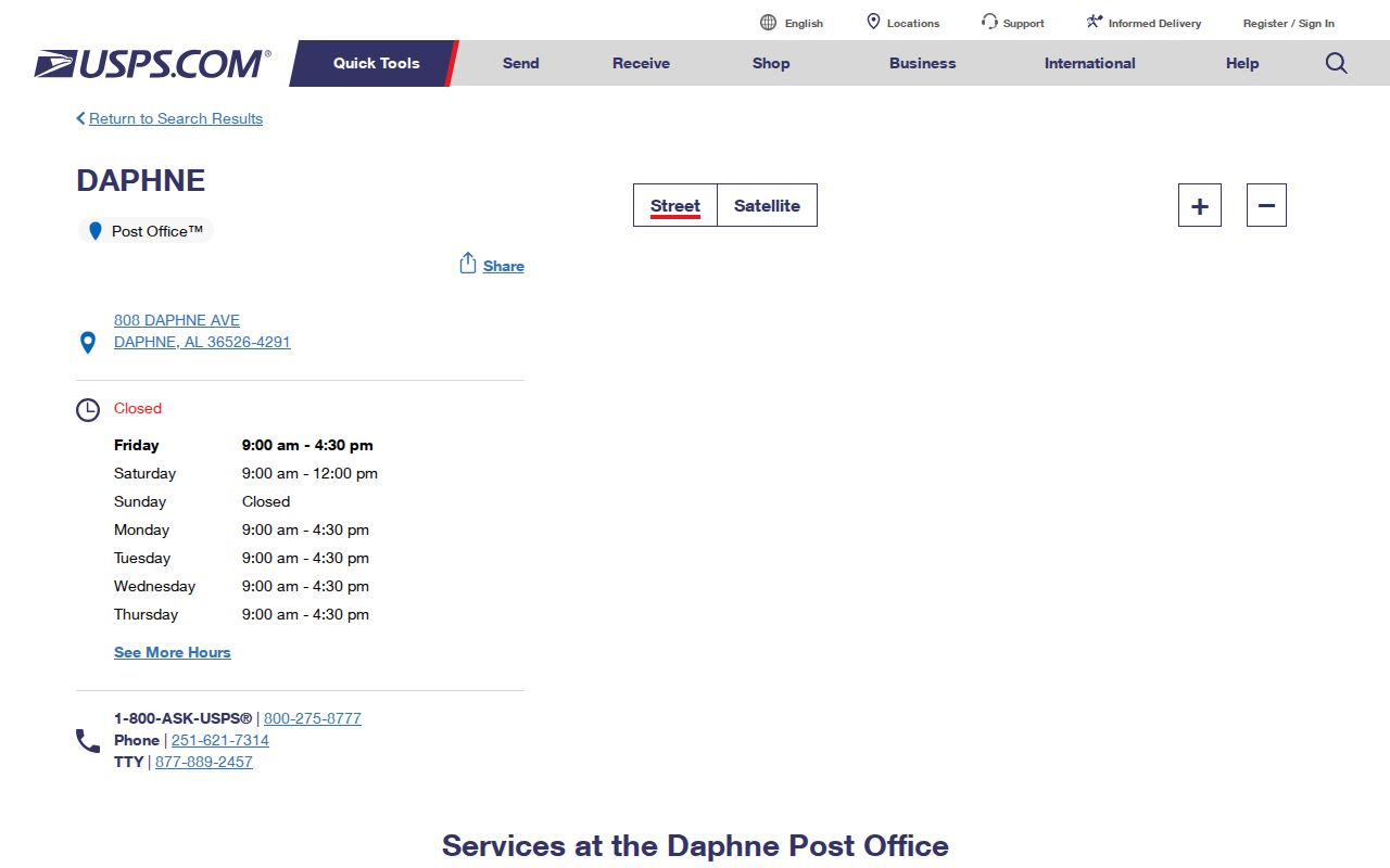
The station page confirms where postal services are offered. It does not provide a list of people served, and it does not establish the city boundary around every 36526 address.
For records work, pair the postal result with the physical address and parcel identifier. The county appraisal record distinguishes the situs address, where the land is located, from the tax mailing address, where notices go. Those two lines can match, but they can also differ for valid reasons.
Daphne ZIP 36527 Overlap
ZIP 36527 is the key geography trap in a Daphne ZIP code search. It serves north Daphne addresses, including a Daphne municipal fire station, and reaches TimberCreek. It also serves Spanish Fort and uses the Spanish Fort Post Office at 6450 Highway 90 Suite 8A. The postal code therefore cannot act as a town boundary.
A north Daphne address may carry 36527 while remaining subject to Daphne city services. Another 36527 address may be in Spanish Fort or an unincorporated part of Baldwin County. City ordinances, county tax records, subdivision plats, and USPS delivery data describe separate layers. Verify each one for the question at hand.
This overlap is the most useful fact in the Daphne ZIP code directory. It prevents a postal label from becoming a false statement about jurisdiction, records custody, or the community tied to a parcel.
Verify Daphne ZIP Codes at USPS
The USPS ZIP Code Lookup offers three routes. Choose the one that matches the known clue. Its result establishes postal formatting and delivery geography, but USPS warns that an address result does not confirm that a named person or business is actually there.
| USPS Mode | Fields Used | Best Daphne Use |
|---|---|---|
| By Address | Optional company, street, and state or ZIP | Confirm one full mailing address |
| By City and State | City and state | Check codes associated with Daphne |
| Cities by ZIP | Five-digit ZIP | See postal city names tied to 36526 or 36527 |
The USPS interface below is the primary postal check for the Daphne ZIP code directory.
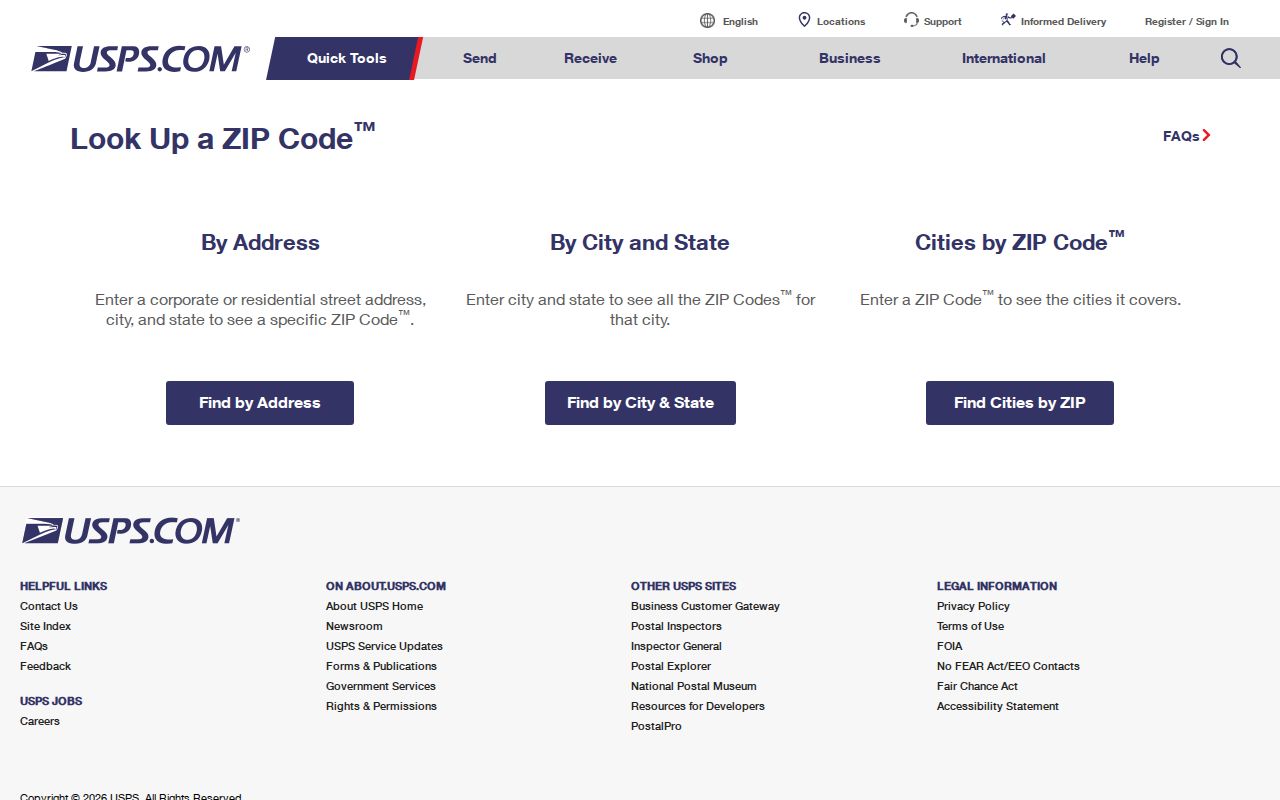
Use the returned standardized address in later county or city searches. Keep the USPS result in its lane: it validates the mail line, not residence or ownership.
Narrow Daphne Residents by ZIP
No verified local portal provides a one-click list of Daphne residents by ZIP. The county assessor does not expose a ZIP search mode, and the recorded-instrument index searches parties, documents, dates, and legal descriptions rather than postal codes. A ZIP-wide task must move from postal area to smaller, verifiable units.
- Confirm 36526 or 36527 through USPS by address, city and state, or cities by ZIP. Save the standardized street form.
- Use Daphne GIS or the Baldwin County parcel map to see streets and parcels within the area. Do not assume the postal edge equals the city line.
- Search the Baldwin County appraisal system by street address. Carry the parcel, PIN, account, physical address, and mailing address into notes.
- If voter data is needed for lawful civic research, request the statutory geographic extract. The self-lookup cannot browse a ZIP or street.
- Once the target narrows to a named road, use the Daphne street directory workflow for address and deed evidence.
This sequence keeps the ZIP code directory focused on geography. It also avoids calling an assessed owner, mailing recipient, voter, or directory entry a current occupant without independent evidence.
Daphne ZIP Voter Extracts
Alabama Votes provides a private self-check, not a public ZIP browser. Its “My Voting Information” mode requires first name, last name, date of birth, and reCAPTCHA. A separate polling-place mode accepts a residential location. These tools can confirm a person's own registration and polling information, but they cannot display everyone in 36526 or 36527.
A geographic list follows a different route under Ala. Code § 17-4-38. The state request form can specify a county, city, or district and choose active, inactive, or both statuses. Available fields include full name, status, residence address, mailing address, race, gender, legislative and local districts, and up to ten elections in which the person voted. Participation history never reveals ballot selections.
Electronic records cost $0.01 per voter, printed output costs $1 per page, and an online order adds 2.5 percent with a $1 minimum. Protected-voter rules can limit public details. The Eastern Shore Board of Registrars counter is at the Fairhope Satellite Courthouse, 1100 Courthouse Avenue, 251-990-4614.
Note: Request the smallest lawful geography needed, then check postal and city limits before labeling the returned addresses as Daphne.
Daphne ZIP Portal Limits
The Baldwin County Revenue Commission property gateway offers Name, PIN, Company, Parcel, Account, Subdivision, and Address modes. Address mode uses street number and street name. It does not have a verified ZIP radio or ZIP filter. Results can show account and parcel identifiers, year, property description, tax figures, and links to more detail.
The Official Records Search likewise has no ZIP field. Its quick screen uses a search term, date range, recent-recording shortcuts, and either Index Only or full-text OCR scope. Advanced search adds party names, grantor and grantee roles, document number, book and page, and subdivision or section legal terms. Those are strong deed tools after a parcel or person is known, but weak tools for defining a postal area.
The verified fallback is visual and address-led. Open the county property search and map launch page, use the parcel map to identify sites, and then carry each address or parcel number into appraisal. Daphne's GIS hub adds city mapping and E-911 context. Neither source should be described as an authoritative ZIP-boundary map.
Daphne ZIPs Versus City Limits
Community Development and GIS manage Daphne E-911 addressing and city mapping. Annexation petitions and ordinances document when land enters city jurisdiction. Annexation does not automatically change the USPS city name or ZIP. A newly annexed parcel can keep its prior postal identity while gaining a new municipal status.
That is why the Daphne ZIP code directory needs more than a shaded postal shape. USPS routing answers how mail moves. The city boundary answers which municipality governs the parcel. County assessment identifies the taxable parcel and owner of record. A subdivision plat fixes lot and block identity. Each should be checked separately when 36527 crosses Daphne and Spanish Fort or when 36526 extends beyond a precise municipal line.
- ZIP
- A five-digit USPS routing code associated with delivery points, not a municipal boundary.
- ZIP+4
- A nine-digit form that narrows delivery to a smaller segment, building, or group of addresses.
- PO-box ZIP
- A code used for post-office boxes. No separate Daphne PO-box-only code was verified.
- Unique ZIP
- A code assigned to one high-volume institution. No Daphne unique ZIP was verified.
- Carrier route
- A set of addresses served along a postal delivery path, which can cross civic lines.
Daphne's 2020 ZIP Label Change
A USPS Domestic Mail Manual processing label groups 36526 and 36527 under DAPHNE AL 36527. In 2020, a postal bulletin changed the mail-processing destination label for that group from Daphne 36526 to Daphne 36527. The change concerned container routing in postal operations.
It was not proof that residents received a new ZIP, that a municipal border moved, or that 36526 stopped serving central Daphne. Treating the label as a residential ZIP split would create false address history. Use the current USPS address lookup for a delivery point and city annexation records for jurisdiction.
Census ZIP Code Tabulation Areas, often called ZCTAs, need the same care. They are statistical approximations built for data reporting, not exact USPS delivery boundaries. Census facts linked to a ZCTA can describe an area, but they cannot confirm the postal code or city status of one Daphne home.
Daphne Growth Shifts Search Geography
Daphne had 27,462 residents in the 2020 census and an estimated 31,396 in July 2025, a 14.0 percent rise. The city covered 19.00 square miles of land in 2020. Growth has converted former forest and farm land into subdivisions, shops, and civic uses while municipal and planning geography has pushed east.
Envision Daphne 2042 was adopted by the Planning Commission on March 28, 2024, and ratified on May 6, 2024. Its planning study projected the city at about 38,010 people in 2041 and the broader planning area at 55,333. Those are planning estimates, not ZIP counts. Still, they explain why an old postal assumption can fail as new streets, annexations, and subdivisions appear.
For long-term research, save the source date with each boundary or address result. A Daphne ZIP code directory result from one year may need a fresh USPS check, while city status should be tied to the annexation record and current municipal map.